A great isolated walk to discover Watendlath tarn by High Lodore. Dog friendly.
Une belle randonnée peu touristique pour découvrir le lac de Watendlath en passant par High Lodore. Accessible aux chiens.
Watendlath tarn by High Lodore walk Information:
- Distance: 8 km
- Duration: 3h30
- Level: Medium
- Ascent: 400 m
- Car park: Small car park along the B5289, just after The Leathes Head Hotel, CA12 5XA.
- What3Words: bloomers.flips.tracking
- Dog friendly: Yes, some field with sheeps.
Today I’m going to talk about a hike we did this summer. We were looking for a place not too far from home and little frequented but still with beautiful landscapes and views. This is why we decided to do this hike. We had been to Watendlath tarn once before and had really liked this little tarn lost in the middle of the valley. So it was a great opportunity to go back there but by taking a different path.
Aujourd’hui je vais vous présenter une randonnée que nous avons faite cet été. Nous recherchions un endroit pas trop loin de la maison et peu fréquenté mais tout de même avec de beaux paysages et vues dégagées. Et c’est ainsi que nous avons décidé de faire cette randonnée. Nous étions allés une fois vers Watendlath tarn et avions beaucoup aimé ce petit lac perdu au milieu de la vallée. C’était donc l’occasion d’y retourner mais en empruntant un chemin différent.
Find our walk from Rosthwaite to Watendlath here.

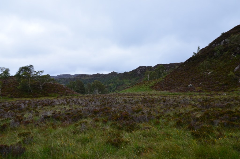
That day the weather was grey but dry and the fog cleared as the day progressed. However, since it had rained quite a bit the days before, the trail was quite muddy and flooded in some places. We only met around ten people, which is not much for a place so close to Keswick.
Ce jour-là le temps était gris mais sec et le brouillard se dégagea au fur et à mesure de la journée. Par contre vu qu’il avait pas mal plu les jours d’avant le sentier était assez boueux et inondé par endroit. Nous ne rencontrâmes qu’une dizaine de personnes ce qui est peu pour un endroit aussi proche de Keswick.

To do this hike, we parked along the B5289 just past the Leathes Head Hotel coming from Keswick. From the parking, we headed in the direction of the hotel and turned right just before the hotel towards the cottages.
Pour faire cette randonnée, nous nous sommes garé le long de la B5289, juste après le Leathes Head Hotel en venant de Keswick. Depuis le parking, nous avons pris la direction de l’hôtel et avons tourné à droite juste avant l’hôtel en direction des cottages.
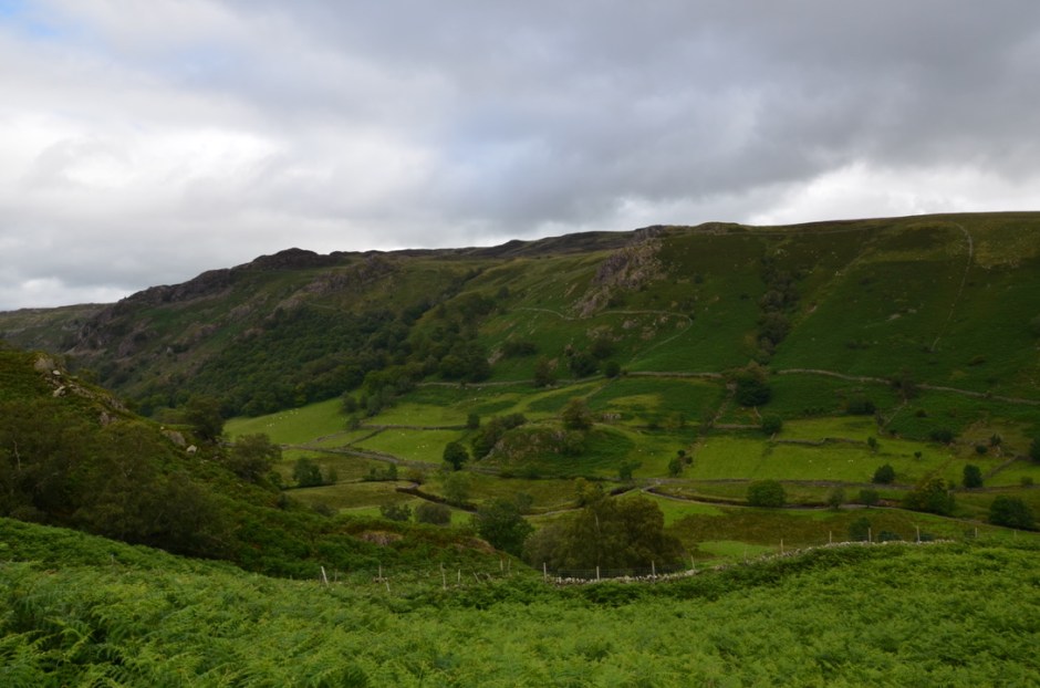
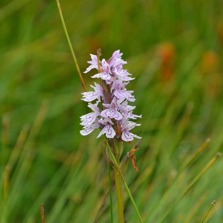
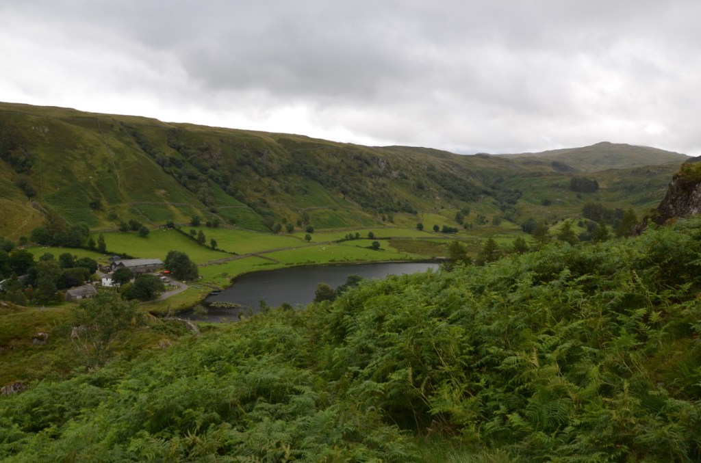
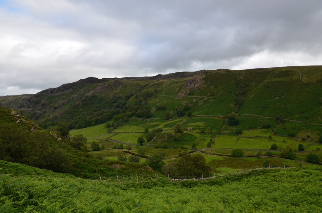
After passing the cottages, we continued straight through the field towards the forest (the path is quite visible) then we went up through the forest to reach a clearing. From this point on the trail disappears until Watendlath tarn. We therefore tried through the fields to bypass the various rocky massifs to reach Brund Fell then Grange Fell and thus descend to Watendlath tarn. This part of the hike was a bit boring as we got lost several times and the ground was very muddy, but the area was full of flowers and the view of the surrounding peaks was great.
Après avoir passé les cottages, nous avons continué tout droit à travers champs en direction de la forêt (le sentier est assez visible) puis nous sommes montés à travers la forêt pour arriver sur une clairière. A partir de ce moment-là le sentier disparait jusqu’à Watendlath tarn. Nous avons donc essayé à travers champs de contourner les différents massifs rocailleux pour atteindre Brund Fell puis Grange Fell et ainsi redescendre vers Watendlath tarn. Cette partie-là de la randonnée était un peu ennuyante car nous sommes perdus plusieurs fois et le sol était très boueux mais l’endroit regorgeait de fleur et la vue sur les sommets environnants était superbe.

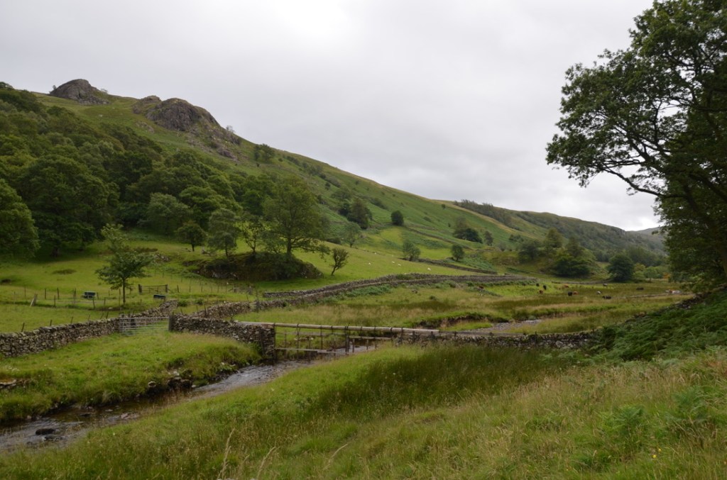
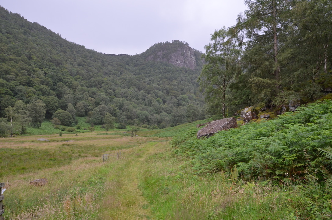
We stopped at Watendlath Lake to eat before heading back to High Lodore along the Watendlath Beck River. This trail is very visible and easy, it is in fact on this part that we saw most of the people. After walking along the river for a while, we turned left at a fork to take the path towards the forest and High Lodore.
Nous nous arrêtâmes au niveau du lac de Watendlath pour manger avant de repartir en direction de High Lodore en longeant la rivière Watendlath Beck. Ce sentier est très visible et facile c’est d’ailleurs sur cette partie que nous avons vu le plus de monde. Après avoir longé pendant un bon moment la rivière, nous prîmes à gauche au niveau d’un embranchement de sentier en direction de la forêt et de High Lodore.

Once on the national road, we turned left to go back to the car. We liked this hike because it is not too hard, not too long and yet offers a variety of landscapes and views.
Une fois sur la route nationale, nous prîmes à gauche pour rejoindre la voiture. Nous avons bien aimé cette randonnée car elle n’est pas trop dure, n’y trop longue et pourtant offre une variété de terrains et vues.
Do you know this place in the Lake District?
Connaissez-vous cet endroit du Lake District?


Find all our dog friendly walks in Lake District National Park in this page. To see all our dog-friendly walks in the UK national parks it is here.

Watendlath is a lovely little secluded village. I walked there in May last year from a different starting point further down Borrowdale – Rossthwaite. Like you I encountered very few people.
LikeLiked by 1 person
We did the walk from Rosthwaite to Watendalth and it was very nice as well.
LikeLiked by 1 person
<amazing walk !
LikeLike
Merci MaryFrance
LikeLike
There’s some lovely countryside in Cumbria, not just in the Lake District. I stayed for a few days in Kirkby Stephen during August and the upper Eden Valley is beautiful.
Unfortunately, the Coronavirus restrictions mean that many hill-walkers and sightseers cannot visit some of their favourite locations at present. Hopefully in the Spring we will be able to once more.
LikeLiked by 1 person
I agree there is a lot of beautiful places to visit outside the Lake District National Park. The West Coast near St Bees and Ravenglass is beautiful.
LikeLike