Circular walk to Dent summit by Nannycatch and starting from Longlands Lake.
Randonnée circulaire jusqu’au sommet de Dent en passant par Nannycatch et commençant du petit lac de Longlands lake.
Dent and Nannycatch walk information:
- Distance: 15 km
- Duration: 4h30
- Ascent: 461 m
- Level: Medium
- Car park: Free at Longlands lake, Cleator Moor, CA23 3AD
- Dog friendly: Yes- some sheeps in the fields
- Tips: The farm sells eggs (£1 for 6) and jam pots (£2.50) that it is possible to buy on the way.

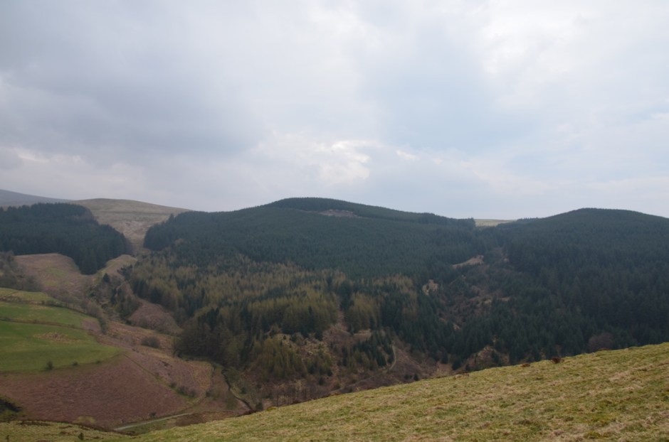
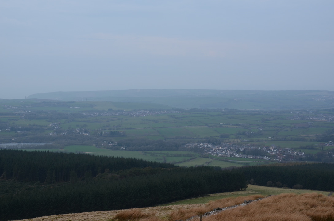
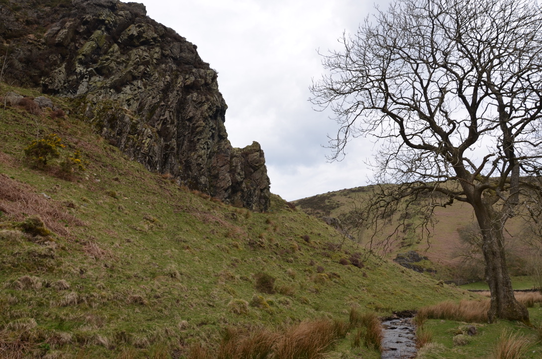
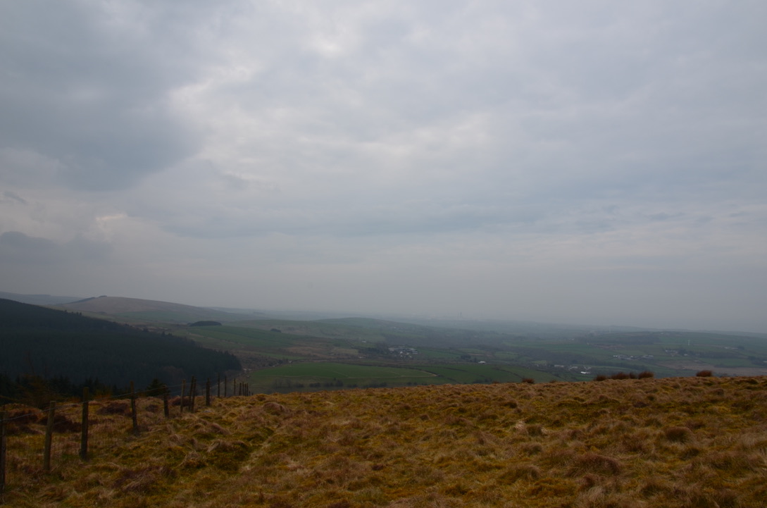
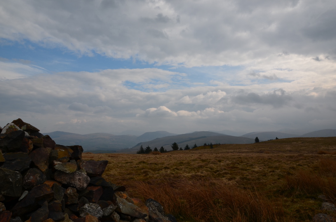
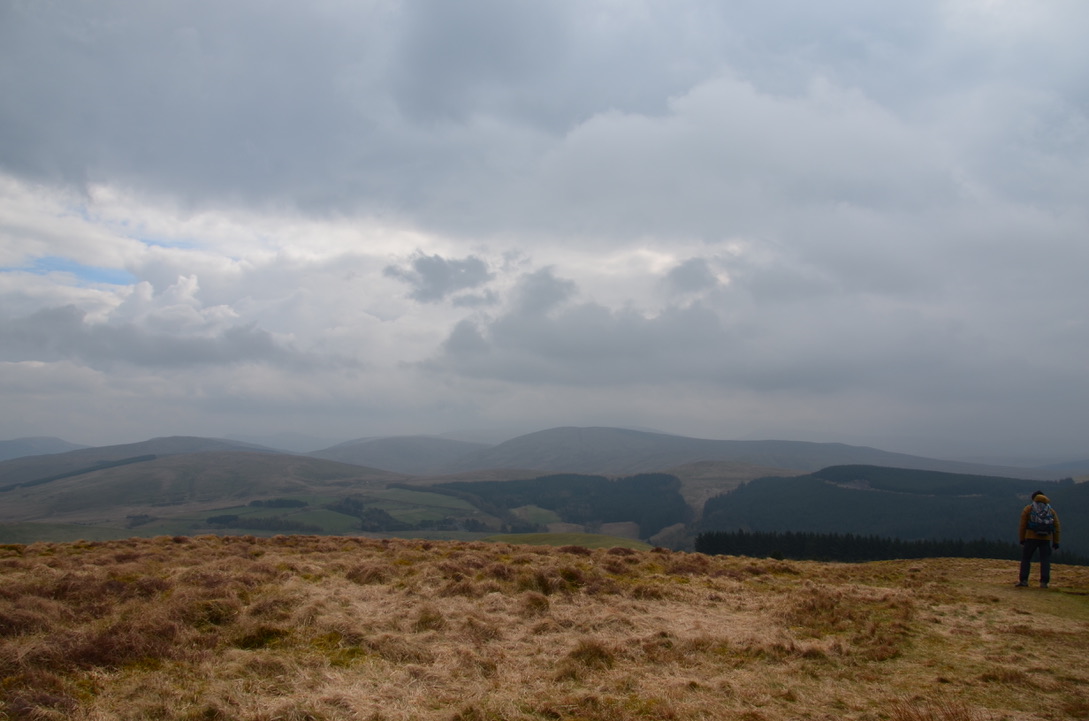
This hike starting from Cleator Moor passes the top of Dent fell and Nannycatch river. This area of Lake District is little known because Dent fell is the most westerly fell in Lake District. Dent fell is also the first summit to climb on the famous Coast to Coast road from St Bees to Robin Hood Bay. This 352-meter peak offers clear views of the Ravenglass Estuary, Southern Scotland and the Isle of Man. In addition, Nannycatch small river, with its limpid waters, created a long time ago this valley displaying steep cliffs. Although, it is now a very calm and beautiful place.
Cette randonnée qui part de Cleator Moor passe par le sommet de la colline Dent et la rivière Nannycatch. Cet endroit de Lake District est peu connu car la colline Dent est la dernière colline la plus à l’ouest de Lake District. Dent est également le premier sommet à gravir de la célèbre route Coast to Coast qui va de St Bees à Robin Hood Bay. Son sommet qui s’élève à 352 mètres offre par temps dégagé une vue sur l’estuaire de Ravenglass, le Sud de l’Ecosse et l’ile de Man. Par ailleurs, la petite rivière Nannycatch avec ses eaux limpides créa il y a fort longtemps cette vallée aux falaises abruptes. C’est maintenant un endroit très calme et de toute beauté.


Here are the key steps to realise this hike:
Voici les étapes clés pour réaliser cette randonnée:
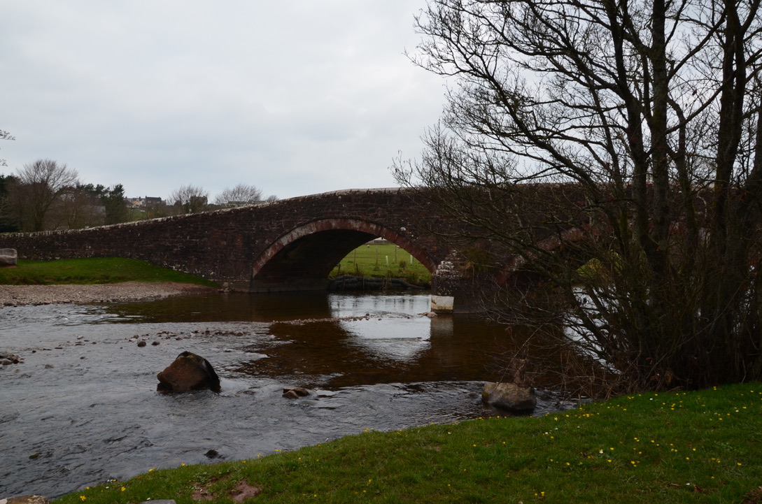
- From the parking, take in direction of Longlands Lake. Just after the bridge take the path on the left following the river. Follow this path until arriving at a farm. Go past the farm and cross the national road. Take the forest path starting in front of the farm.
- Follow this forest path until you see a well-marked path on the left. Then take right on the marked trail. Continue for a moment (always straight) until you reach the top of Dent. Continue straight on until you reach a tarmac road. Turn left, then right at the high ladder. Climb the stile then walk straight for a little while until you have a view of the valley below. This valley is Nannycatch. Retrace your steps. Once the stile passed again, turn left towards the forest.
- Continue on the tarmac path, then at an intersection turn left to take the path that goes down through the forest. Follow the path that zigzags to a gate. At the gate continue straight towards a small gate and a path that follows Nannycatch river.
- Continue on the trail until you reach another gate, which is Nannycatch Gate. Take opposite right on the path that runs along a low rocky wall. Continue for a moment until you reach an intersection, take the road on the left that crosses the river. Then take the left path that runs along Flat fell by its foot. Continue on the path until you reach a parking. Continue straight along the tarmac road until you reach an intersection. Take a left and then left again before the bridge.
- Continue until you reach the farm that you saw at the beginning of the walk. From the farm follow the path that will lead you back to the car.
- Depuis le parking, prendre en direction du lac Longlands. Juste après le pont prendre le chemin sur la gauche qui suit la rivière. Suivre ce chemin pendant un long moment avant d’arriver devant une ferme. Passer devant la ferme et traverser la nationale. En face de la ferme prendre le chemin forestier.
- Suivre ce chemin forestier jusqu’à voir un chemin marqué sur la gauche. Puis prendre à droite sur le sentier marqué. Continuer pendant un moment toujours tout droit jusqu’à arriver au sommet de Dent. Continuer toujours tout droit jusqu’à arriver sur un chemin goudronner. Prendre à gauche, puis à droite au niveau de la grande échelle. Gravir l’échelle puis marcher tout droit pendant un petit moment jusqu’à avoir une vue sur la vallée du dessous. Cette vallée est Nannycatch. Revenir sur vos pas. Arriver à l’échelle prendre à gauche vers la forêt.
- Continuer sur le sentier goudronne, puis au niveau d’une intersection prendre à gauche le sentier qui descend à travers la forêt. Suivre le sentier qui zigzague jusqu’à un portail. Au niveau du portail continuer tout droit en direction d’un petit portillon et d’un sentier qui suit la rivière Nannycatch.
- Continuer sur le sentier jusqu’à arriver à un autre portillon qui est Nannycatch Gate. Prendre en face à droite sur le sentier qui longe un muret. Continuer pendant un moment jusqu’à arriver à un croisement de chemin dont l’un traverse la rivière. Prendre le chemin de gauche qui longe Flat fell par son pied. Continuer sur le sentier jusqu’à arriver au niveau du parking. Continuer tout droit le long de la route goudronnée jusqu’à arriver à une intersection. Prendre à gauche puis encore à gauche avant le pont.
- Continuer sur cette route jusqu’à arriver à la ferme que vous avez passé le matin. Depuis la ferme suivait le chemin en sens inverse qui ramène à la voiture.
We enjoyed this hike even though the day was cloudy. Only the climb to Dent is difficult and once arrived at the top the trail just goes down. The passage through the forest is quite nice and the fact that there are not many people is really relaxing. We had a picnic on the edge of the stream. The only downside of this hike is the way back, which is partly on the road. The road is not very busy but it would have been better to use a smaller path. We recommend doing this hike on a clear day to fully enjoy the view.
Nous avons bien aimé cette randonnée même si ce jour-là le temps était nuageux. Seule la montée jusqu’à Dent est difficile et une fois arrivée en haut le sentier ne fait que redescendre. Le passage à travers la forêt est assez agréable et le fait qu’il n’y ait pas beaucoup de monde assez relaxant. Nous avons pique-niqué le long du cours d’eau. Le seul petit bémol de cette randonnée est le chemin du retour qui se fait en partie sur la route. Cette route n’est pas très fréquentée mais bon ça aurait été mieux d’utiliser des sentiers. Nous recommandons de faire cette randonnée par temps dégagé.
Do you know Nannycatch and Dent?
Connaissez-vous Nannycatch et Dent?


Find all our dog-friendly walks in Cumbria in this page. To read our adventures in the UK it is here.
