
Great easy scrambling route to Blackden Brooks summit in the Peak District National Park.
Jolie randonnée circulaire dans le parc national du Peak District. Cette randonnée nécessite un peu d’escalade.
Blackden Brooks Walk Information:
- Distance: 7.6 km
- Duration: 3h
- Ascent: 315m
- Level: Hard
- Car park: Along Snake Road (SatNav Coordinates 53.40214, -1.80601)
- Dog friendly: No
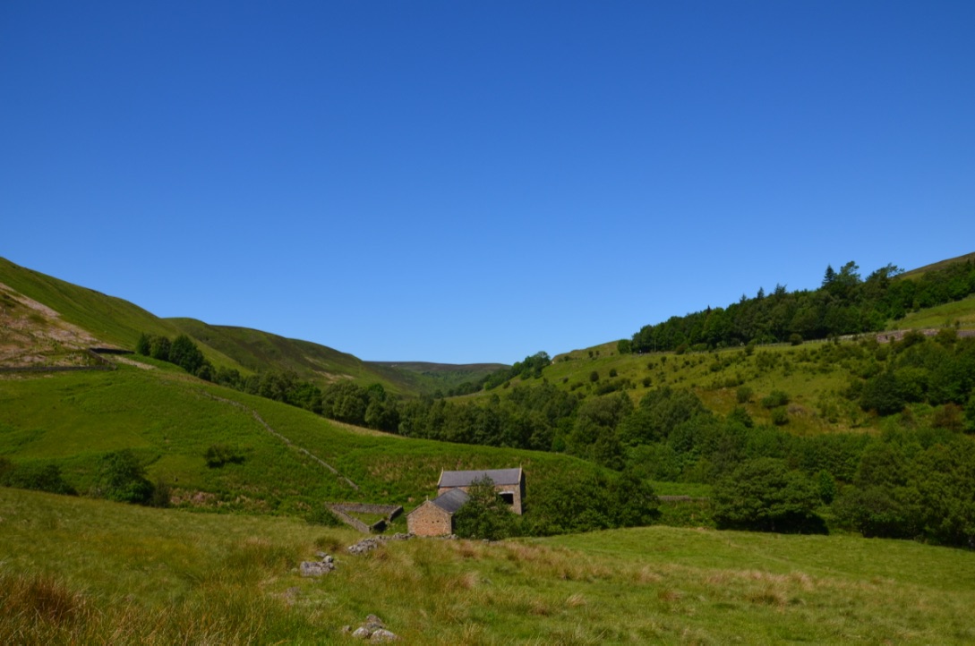
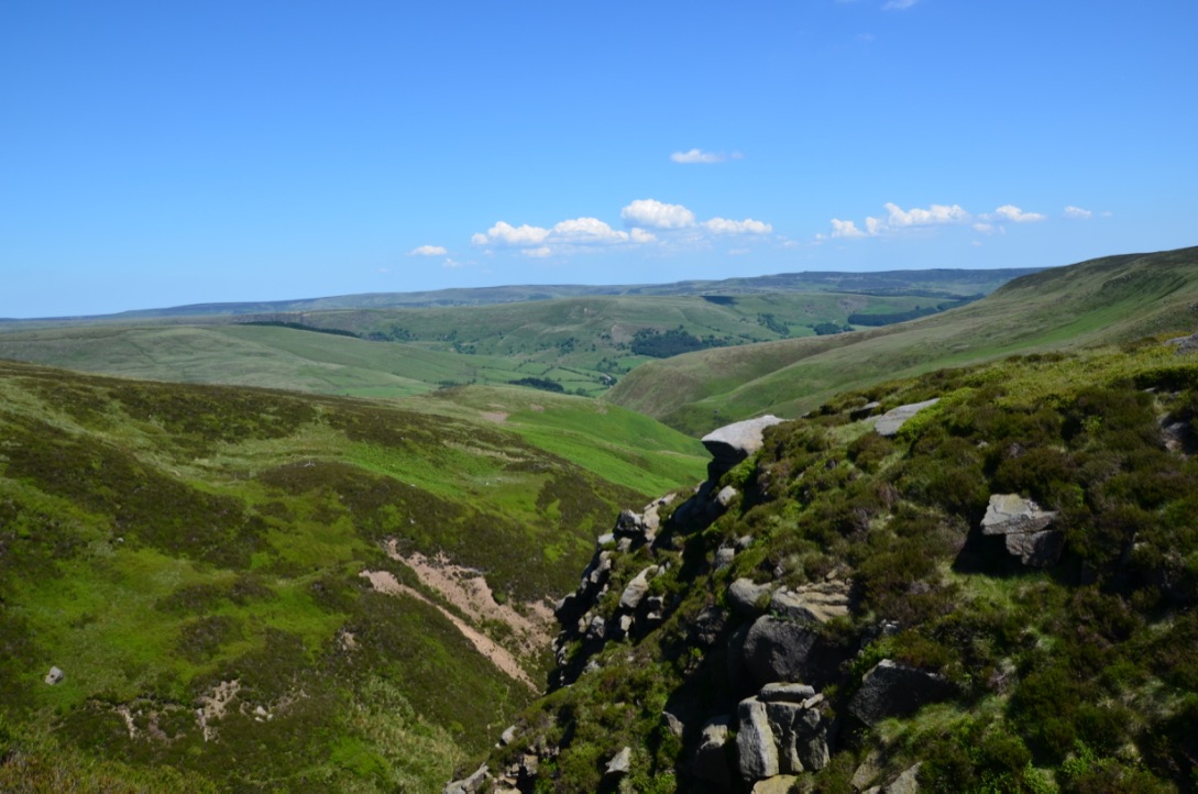
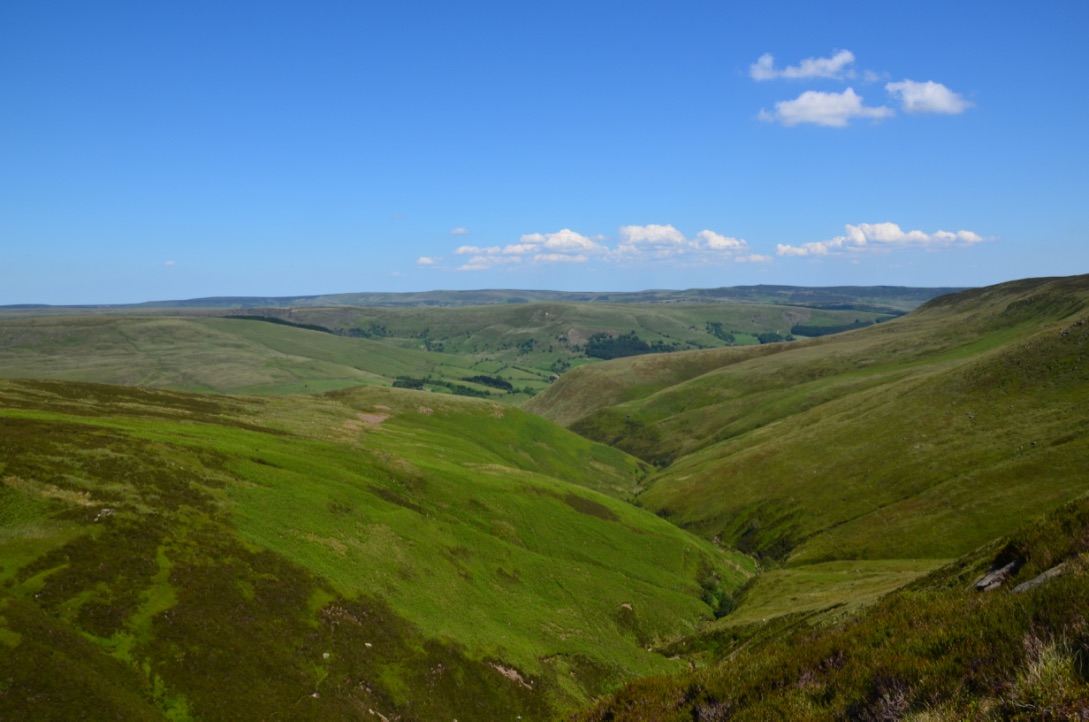
It is thanks to the website Couchsurfing that we met Braxton who like us wanted to go hiking. He chose this hike for us and I have to say it was a very good choice. The first few kilometers are a bit hard for people who are not used to walk because the trail just goes up but once up the hill the view is breathtaking. The descent can be difficult because there is not really a path and you have to walk in the grass.
C’est grâce au site Couchsurfing que nous avons rencontré Braxton qui comme nous avait envie d’aller faire des randonnées. C’est lui qui a choisi cette randonnée pour nous et je dois dire que c’était un très bon choix. Les premiers kilomètres sont un peu dur pour les gens qui ne sont pas habitués à marcher car le sentier ne fait que monter mais une fois en haut de la colline la vue et à couper le souffle. La descente peu être aussi difficile car il n’y a pas vraiment de chemin et il faut marcher dans l’herbe.
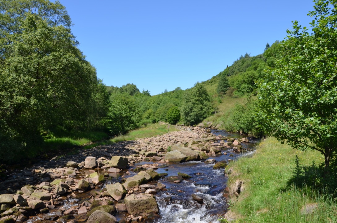
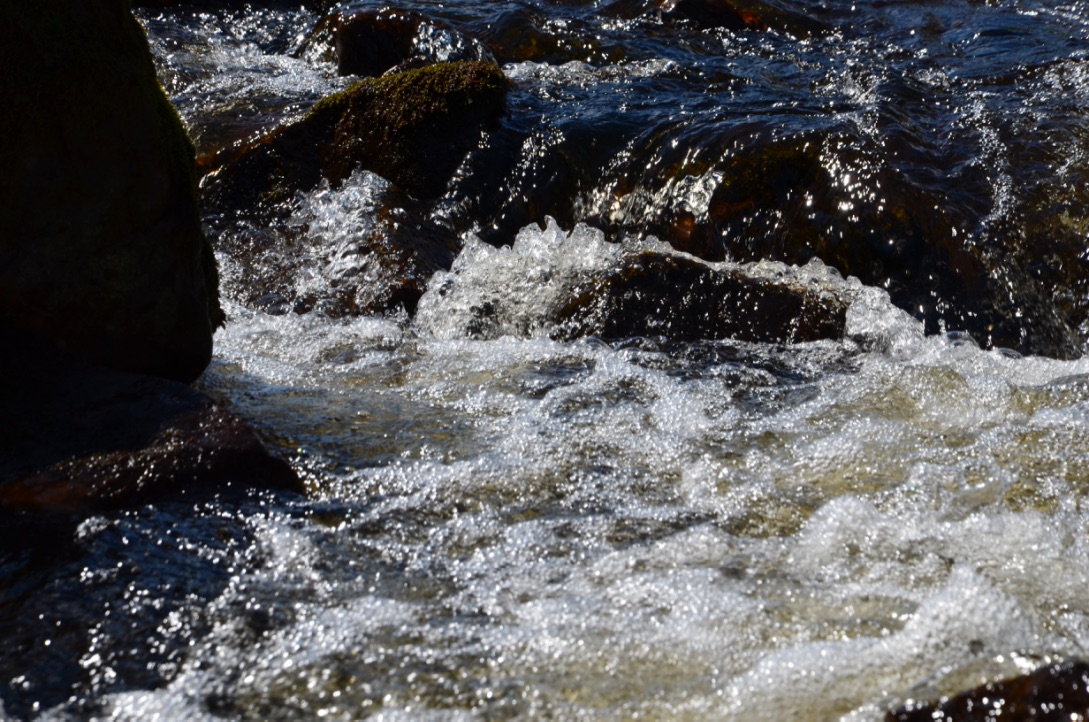
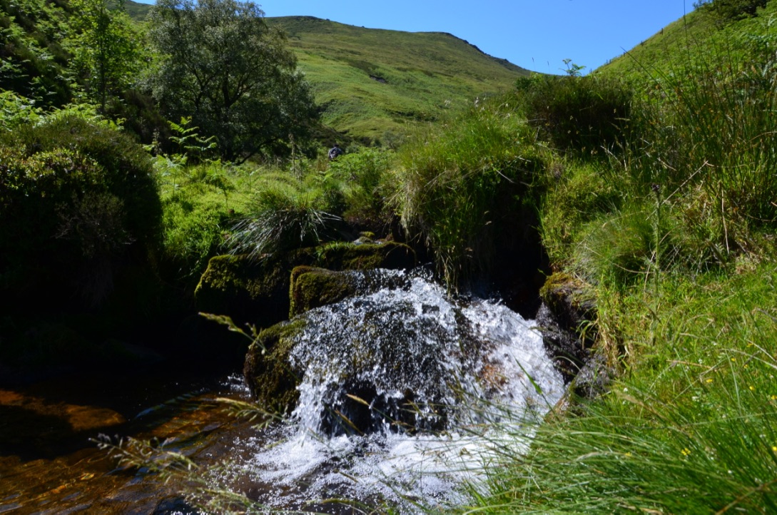
The path runs along a river for a while, which makes this hike very enjoyable. There are even places where you can soak your feet in the water. This is what we did at the end of the hike. There is a part of the hike where you have to climb / scramble a few big rocks but this is done easily without any necessary equipment.
Le chemin longe pendant un bon moment une rivière ce qui rend la randonnée super agréable. Il y a même des endroits où il est possible de se tremper les pieds dans l’eau. Ce que nous avons fait a la fin de la randonnée. Il y a une partie de la randonnée où il faut escalader un petit peu de gros rochers mais cela se fait facilement sans aucun équipement nécessaire.
We absolutely loved this hike and with the wonderful sun we had the view was absolutely magical.
Nous avons vraiment adoré cette randonnée et avec le magnifique soleil que nous avons eu la vue était absolument magique.
Here are the steps to do this hike:
Voici les étapes pour réaliser cette randonnée:
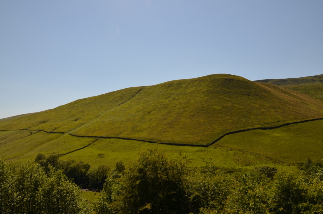
- From the parking follow the path down to the river. Cross the river and follow the path until you see a gate on the left. Pass the gate and follow the path that goes up the hill with a stone wall on the right;
- Follow this path until reaching the foot of the hill, the path divides to go to the top. The trail on the left is composed of big rocks that you have to climb (the one we took) while the trail on the right is a little easier to access;
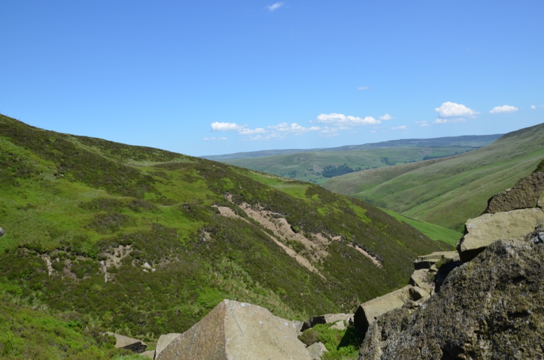
- Once at the top, follow the path that goes to the right (if you look down, or that goes left if you look straight ahead) and that runs along the cliff. Continue for a while;
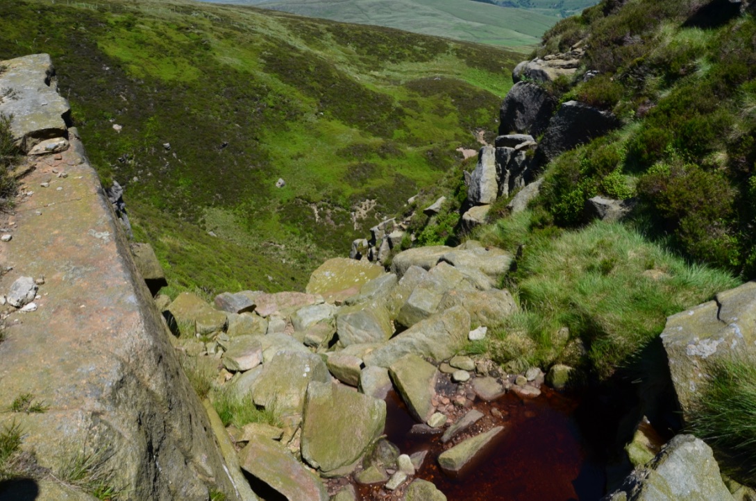
- Approximately at 5.5 km from the beginning of the walk you will see a dry river that descends. Follow this path to the bottom of the hill and you will arrive in front of the gate. The descent is a bit of at a guess because there is not really a trail.
- Depuis le parking suivre le chemin qui descend vers la rivière. Traverser la rivière et suivre le chemin jusqu’à voir un portillon sur la gauche. Passer le portillon et suivre le chemin qui va vers le haut de la colline avec un muret en pierre sur la droite.
- Suivre ce chemin jusqu’à arriver au pied de la colline, le sentier se divise pour aller au sommet. Le sentier de gauche est composé de gros rochers qu’ils faut escalader (celui que nous avons pris) alors que le sentier de droite est un peu plus facile d’accès.
- Une fois en haut, suivre le sentier qui part vers la droite (si vous regardez vers le bas, ou qui part à gauche si vous regardez droit devant vous) et qui longe la falaise. Continuer pendant un bon moment.
- A environ 5.5 km depuis le début de la marche vous verrez un rivière à sec qui redescend. Suivre ce chemin jusqu’en bas de la colline et vous arriverez devant le portillon. La descente est un peu au pifomètre car il n’y a pas vraiment de sentier.
Do you know this hike? Do you want to test it?
Connaissez vous cette randonnée? Avez vous envie de la tester?
Find all our walks in the Peak District National Park on this page. To discover Cumbria it is here.

Cette randonnée a l’air super sympa. Je ne connais pas bien le Peak District (en effet, je n’ai fait qu’une randonnée de 4 jours là-bas, il y a quatre ans) mais j’aimerais bien découvrir plus de chemins dans ce parc dans l’avenir 🙂
LikeLike
Si tu viens vers Peak District fais moi signe on pourra aller faire une randonnée ensemble si tu veux.
LikeLiked by 1 person
Ça sera génial – j’habite à 1h de Manchester, donc pas loin du Peak District. Je suis à la recherche d’un emploi en ce moment, mais j’espère que j’aurai un peu plus de temps libre bientôt !
LikeLike
Bon courage dans ta recherche d’emploi. Je t’envoie un mail dès que je planifie une rando à Peak District (je pense en août).
LikeLiked by 1 person