Popular walk to visit Castle Crag and the little caves in the Borrowdale forest passing by the villages of Rosthwaite and Seatoller. Dog friendly.
Une randonnée assez connue pour visiter le sommet de Castle Crag et les petites grottes de Borrowdale forest en passant par les villages de Rosthwaite et Seatoller. Accessible aux chiens.
Castle Crag by Seatoller walk Information:
- Distance: 10km
- Duration: around 3h30
- Ascent: 304m
- Level: Easy
- Car Park: National Trust car park, Rosthwaite, CA12 5XB, £7.50 a day or free for NT member, cash only.
- Dog friendly: Yes, some sheeps in the fields, some stiles.
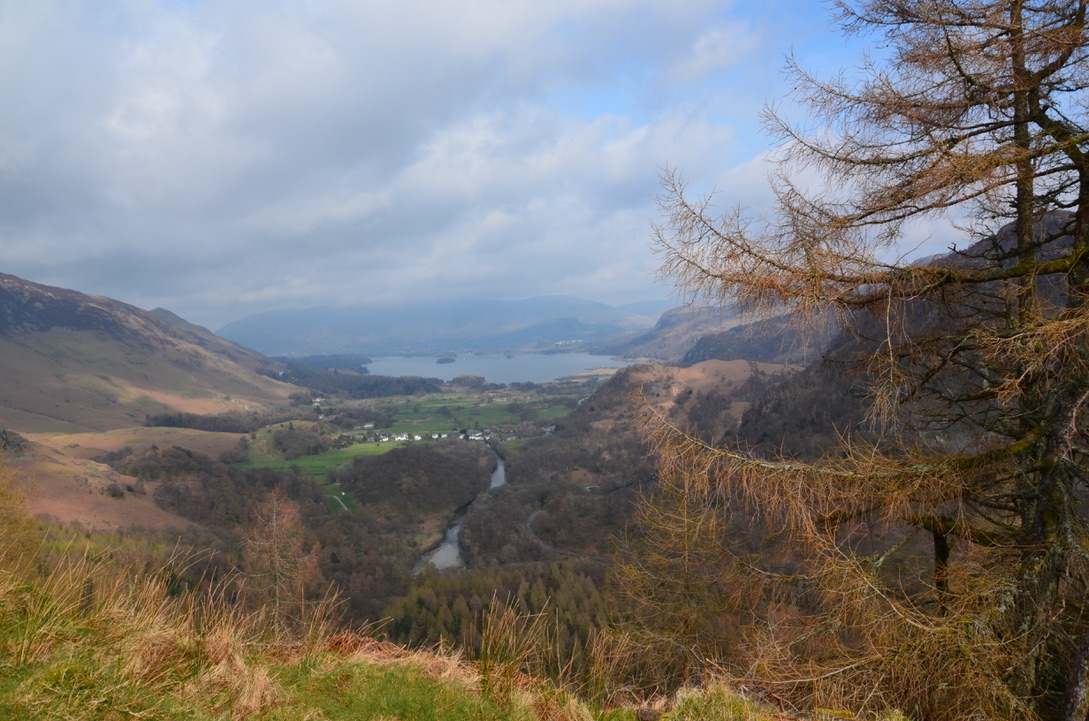
Last weekend we had friends at home and as they wanted to go for a hike, we decided to bring them to Castle Crag. My colleague and George from the Lakeland Walking Tales blog recommended us this place. Castle Crag is located in the Borrowdale Valley south of Keswick. It is the smallest summit referenced in Alfred Wainwright’s book series.
Le weekend dernier nous avions des amis à la maison et vu qu’ils voulaient faire une randonnée, nous avons décidé de les amener faire Castle Crag. Mon collègue ainsi que George du blog Lakeland Walking Tales m’avaient recommandé cet endroit. Castle Crag est situé dans la vallée de Borrowdale au sud de Keswick. C’est le plus petit sommet référencé dans la série des livres d’Alfred Wainwright.

We decided to go to Castle Crag starting from Rosthwaite National trust car park and I combined two roads that I found in Country Walking magazine to plot this one. This route runs along the Derwent River and allows you to take a walk through the caves before climbing towards Castle Crag and going down to the village of Seatoller and back to the car park passing the Borrowdale youth hostel.
Nous avions décidé de faire Castle Crag en commençant depuis le parking de Rosthwaite et de combiner deux routes que j’avais trouvé dans le magazine Country Walking pour faire celle-ci. Ainsi cette route longe tout d’abord la rivière Derwent et permet de faire un tour par les grottes avant de remonter en direction de Castle Crag pour redescendre vers le village de Seatoller et de rejoindre le parking en passant devant l’auberge de jeunesse de Borrowdale.

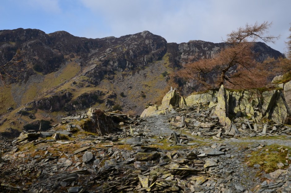
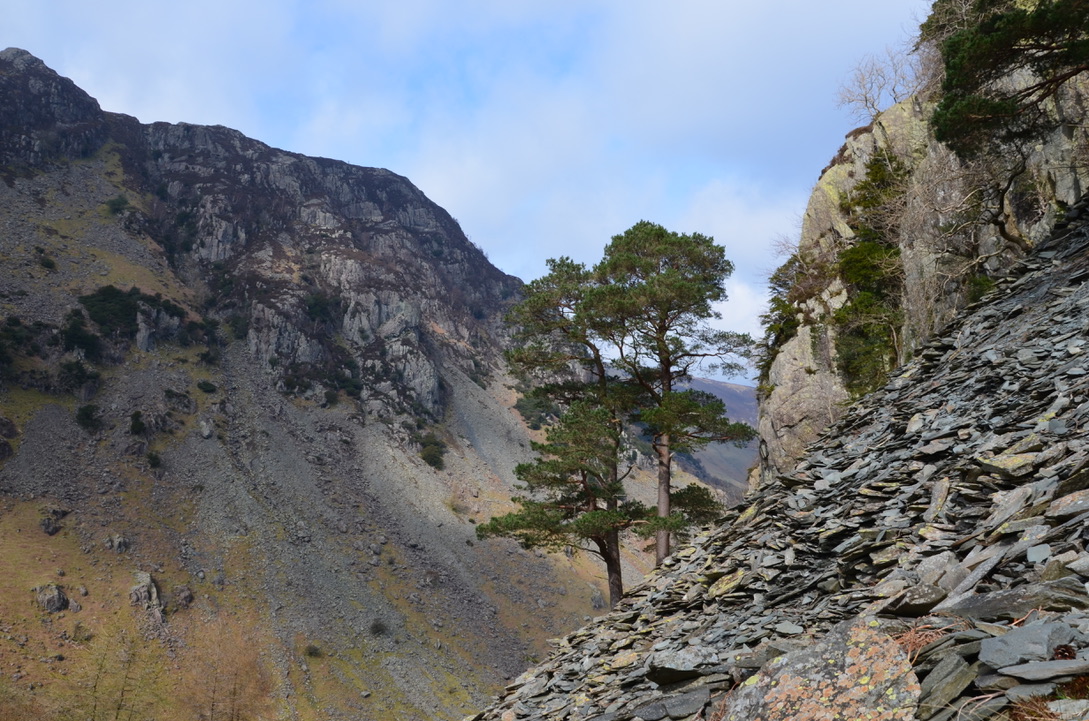
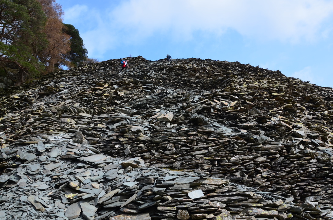
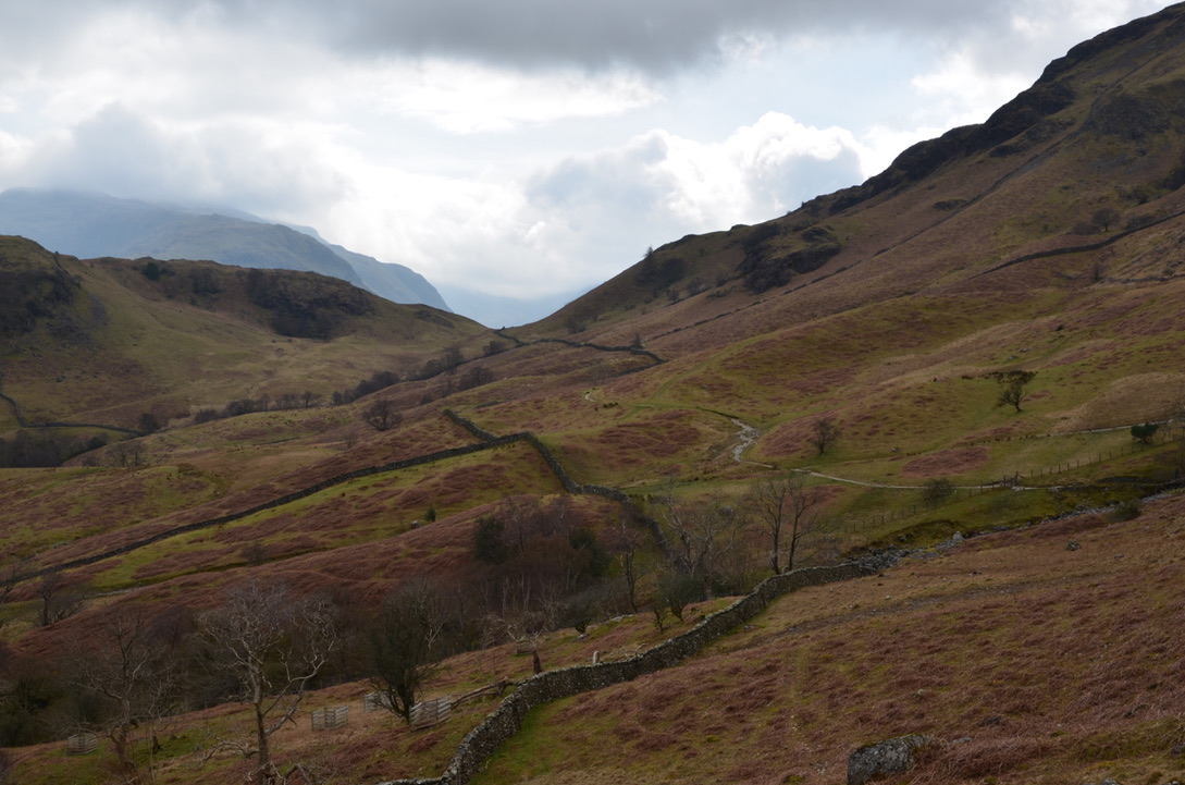
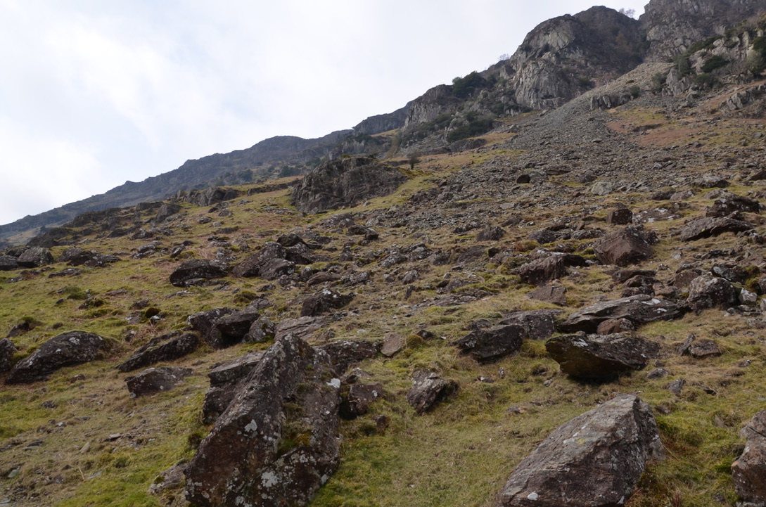
To be honest I did not think this hike was going to be so nice and I was pleasantly surprised by this place. Although Castle Crag is not very high, it has an unobstructed view over the southern part of Derwentwater. Also, the old slate mine is very interesting as well as the two small caves. Then the path that goes to Seatoller allows you to see the beautiful Borrowdale valley.
Pour être honnête je ne pensais pas que cette randonnée allait être aussi joli et j’ai été agréablement surprise par cet endroit. Même si Castle Crag n’est pas très haut, il a une vue dégagée sur le sud du lac de Derwent water. Aussi l’ancienne mine d’ardoise est très intéressante ainsi que les deux petites grottes. Puis le sentier qui va vers Seatoller permet de voir la magnifique vallée de Borrowdale.
It is also an easy hike perfect for spending a day with the family. Here are the key steps to do this hike:
C’est également une randonnée assez facile parfaite pour passer une journée en famille. Voici les étapes clés pour réaliser cette randonnée:
-From the car park, take the path that goes toward the Flock in tearoom. Take right after the tearoom on the path that goes towards the river and follow it to the bridge. Cross the stone bridge and turn right.
-Depuis le parking prendre en direction du salon de thé The flock in. Prendre à droite après le salon de thé sur le sentier qui va en direction de la rivière et la suivre jusqu’au pont. Traverser le pont en pierre et prendre à droite.
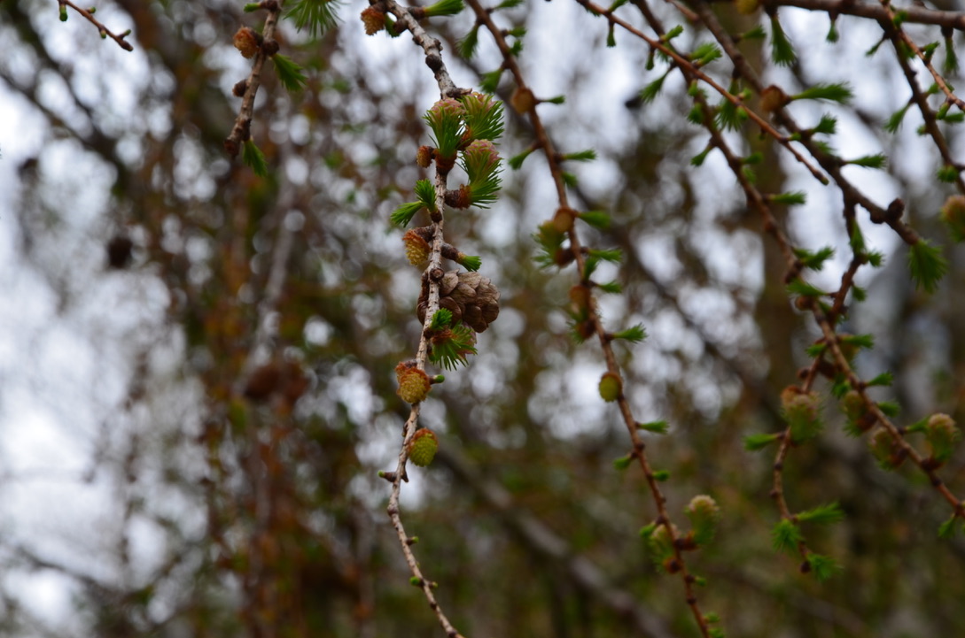
-Follow this path for a long time. It passes through a forest and there are two caves on the left that can be visited. Arrive at a gate and a road intersection turn left towards Seatoller and Castle Crag.
-Suivre sur ce sentier pendant un long moment. Il passe à travers une forêt et il y a deux grottes sur la gauche qu’il est possible de visiter. Arriver à une barrière et une intersection de chemin prendre à gauche en direction de Seatoller et Castle Crag.
-Continue on the trail until you see a path on the left that goes to the top of Castle Crag. Follow this path to the top. Then go down and take the path opposite to join the big path that you had left to go to Castle Crag. Take a left on the path.
-Continuer sur le sentier jusqu’à voir un sentier sur la gauche qui va vers le sommet de Castle Crag. Suivre ce sentier jusqu’en haut. Puis redescendre et prendre le sentier d’en face pour rejoindre le gros sentier que vous aviez quitté pour aller vers Castle Crag. Prendre à gauche sur le sentier.
-Follow this path for a long time until you see the path that goes left to Seatoller. Continue on this path but always go to the left path to go through the top of Seatoller and go towards Longthwaite. Once at the YHA Borrowdale cross the river and follow the path to Rosthwaite and the car park.
-Suivre ce sentier pendant un long moment jusqu’à voir le sentier qui part à gauche vers Seatoller. Continuer sur ce sentier mais aller toujours vers le sentier de gauche pour passer par le haut de Seatoller et prendre en direction de Longthwaite. Une fois au niveau de l’auberge de jeunesse de Borrowdale (YHA Borrowdale) traverser la rivière et suivre le sentier qui va en direction de Rosthwaite et du parking.
Do you know this place? Would you like to do this hike?
Connaissez-vous cet endroit ? Auriez-vous envie de faire cette randonnée?


Find all our dog friendly walks in the Lake District National Park here. To discover the United Kingdom it is here.

Looks the perfect hike. 🙂
LikeLiked by 1 person
It is a great one indeed.
LikeLike
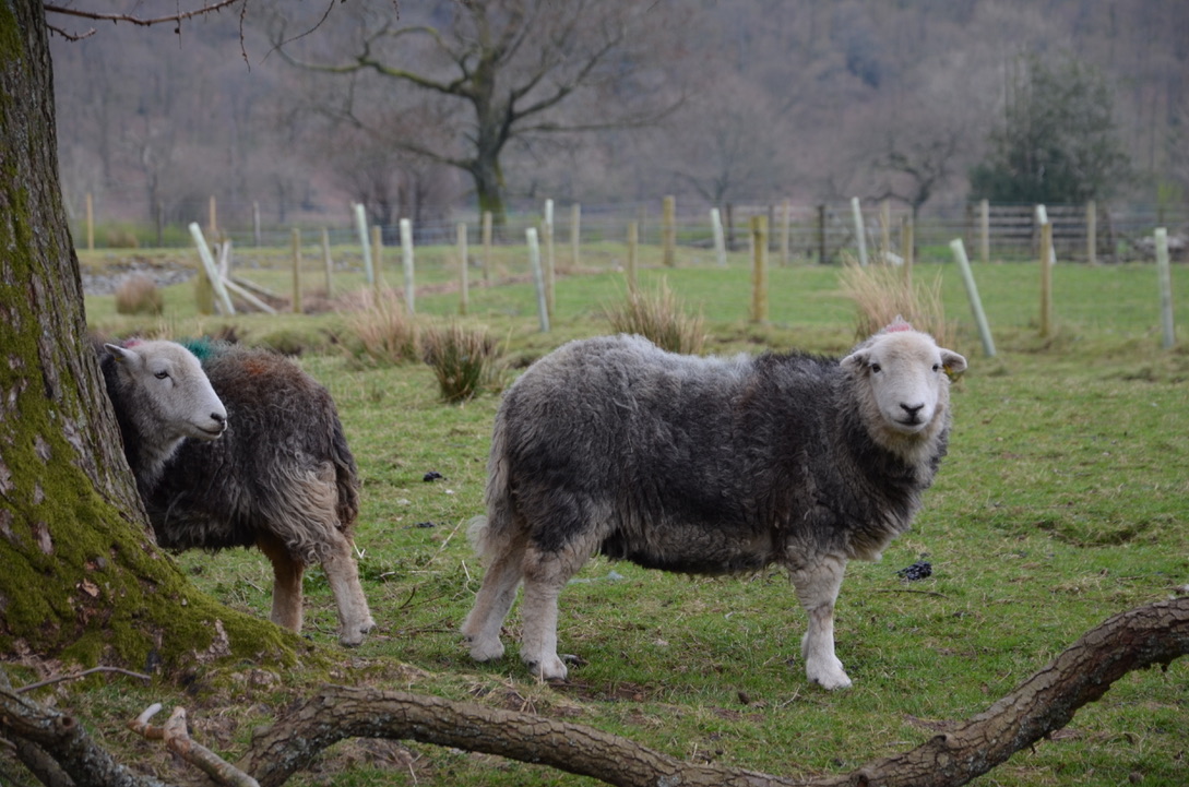
Très belles photos 🙂 J’adore les moutons “Herdwick”, on ne les trouve qu’au Lake District.
LikeLiked by 1 person
Je suis d’accord avec toi ils sont trop mignons.
LikeLiked by 1 person
We love Castle Crag too, lovely family walk 😀
LikeLiked by 1 person
Glad you enjoyed it. Great photos.
LikeLiked by 1 person
Thanks
LikeLiked by 1 person