
Great walk to Carrock Fell. The path to the summit is very steep but short. A bit of scrambling to reach the summit.
Une randonnée assez difficile jusqu’au sommet de Carrock Fell. Le sentier est assez raide mais court et avec un peu d’escalade pour atteindre le sommet.
Carrock Fell walk information:
- Distance: 5km
- Duration: 2h
- Ascent: 413m
- Level: Medium
- Car parking: Along the road after the village of Mosedale, CA11 0XQ
- Dog friendly: Might be difficult for some dogs as the path to Carrock fell summit is a bit of a scramble, sheeps in the fields.

Last Sunday, we wanted to go for a hike during the morning as they had announced some rain for the afternoon. At first, we wanted to do a 10 km circuit that went through Carrock Fell, Round Knott, Milton Hill and High Pike. But when we arrived at the top of Carrock Fell the wind was so strong and so cold that we decided to shorten this hike.
Dimanche dernier, nous avions envie de faire une petite randonnée le matin car ils annonçaient de la pluie pour l’après-midi. Au début nous voulions faire un circuit de 10 km qui passait par Carrock Fell, Round Knott, Milton Hill et High Pike. Mais une fois arrivé en haut de Carrock Fell le vent était tellement fort et glacial que nous décidâmes de raccourcir la balade.
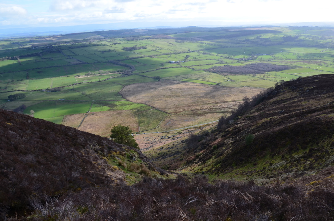
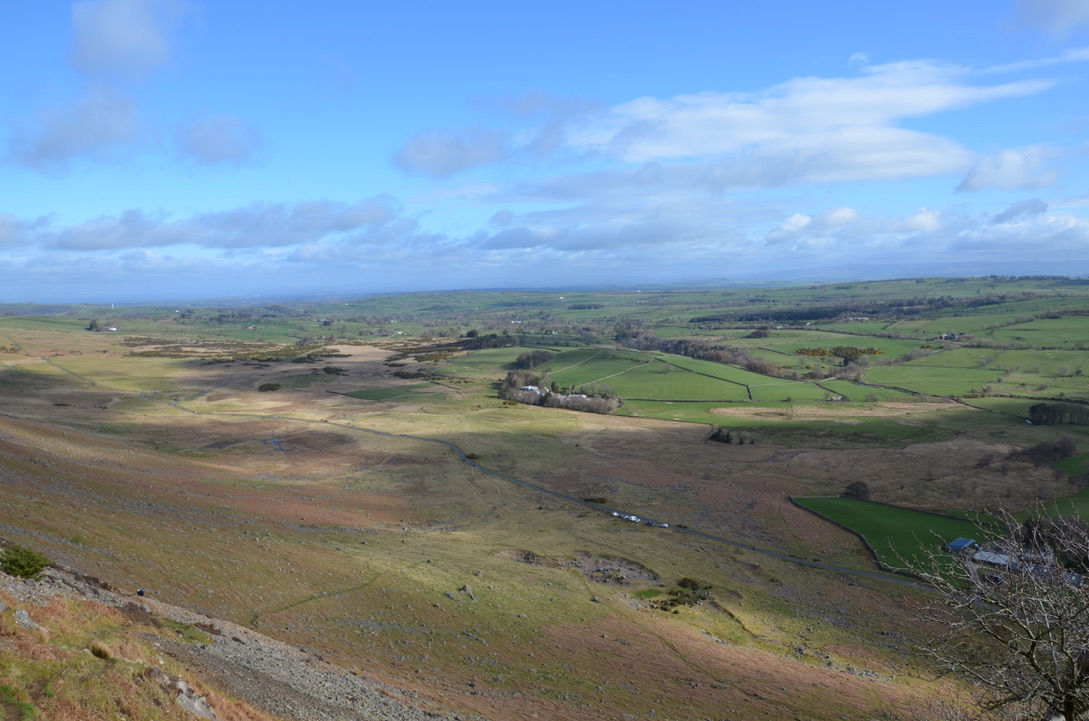
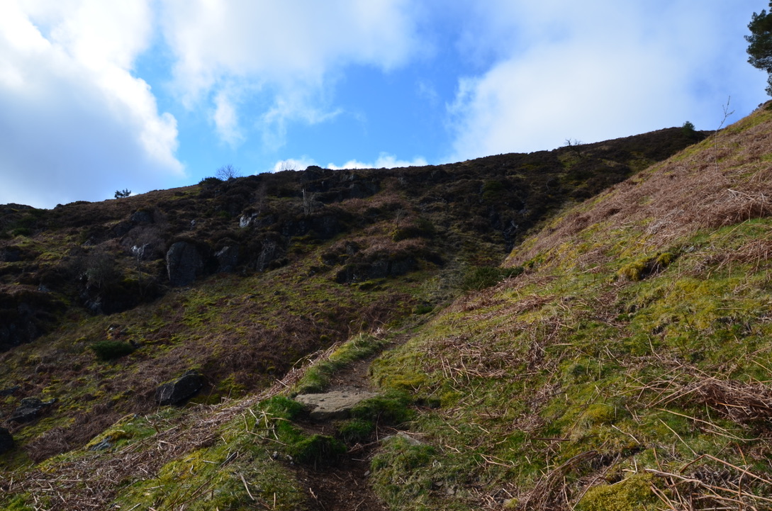
It is better to hike in the direction we followed because the first climb to Carrock Fell is very steep and going down there would be limit dangerous. The hike is short but quite challenging until the top of Carrock Fell. Once at the top the path is either flat or goes down. The view from the summit extends far to the plains and the surrounding peaks.
Il est préférable de faire la randonnée dans le sens que nous avons suivi car la première montée vers Carrock Fell est très raide et descendre par-là serait limite dangereux. La randonnée est courte mais assez éprouvante jusqu’en haut de Carrock Fell. Une fois en haut c’est soit plat soit ça descend. La vue depuis le sommet s’étend loin sur la plaine et les sommets environnants.

I think we will be back again soon to do the other peaks as we enjoyed a lot this hike and we want to discover more of this part of the Lake District. The small villages along the road were also very cute and full of charm.
Je pense que nous y retournerons bientôt pour faire les autres pics car cette randonnée nous a beaucoup plu et nous a donné envie de découvrir un peu plus de cette partie de Lake District. Les petits villages le long de la route sont également très mignons et plein de charme.

Here are the steps to do this hike:
Voici les étapes pour faire cette randonnée:
-From the parking, take the path that climbs to the top of the first summit. Continue on this trail for a good while until you reach the top of Carrock Fell.
-Depuis le parking, prendre le sentier qui monte vers le haut du premier sommet. Continuer sur ce sentier pendant un bon moment jusqu’à arriver en haut de Carrock Fell.
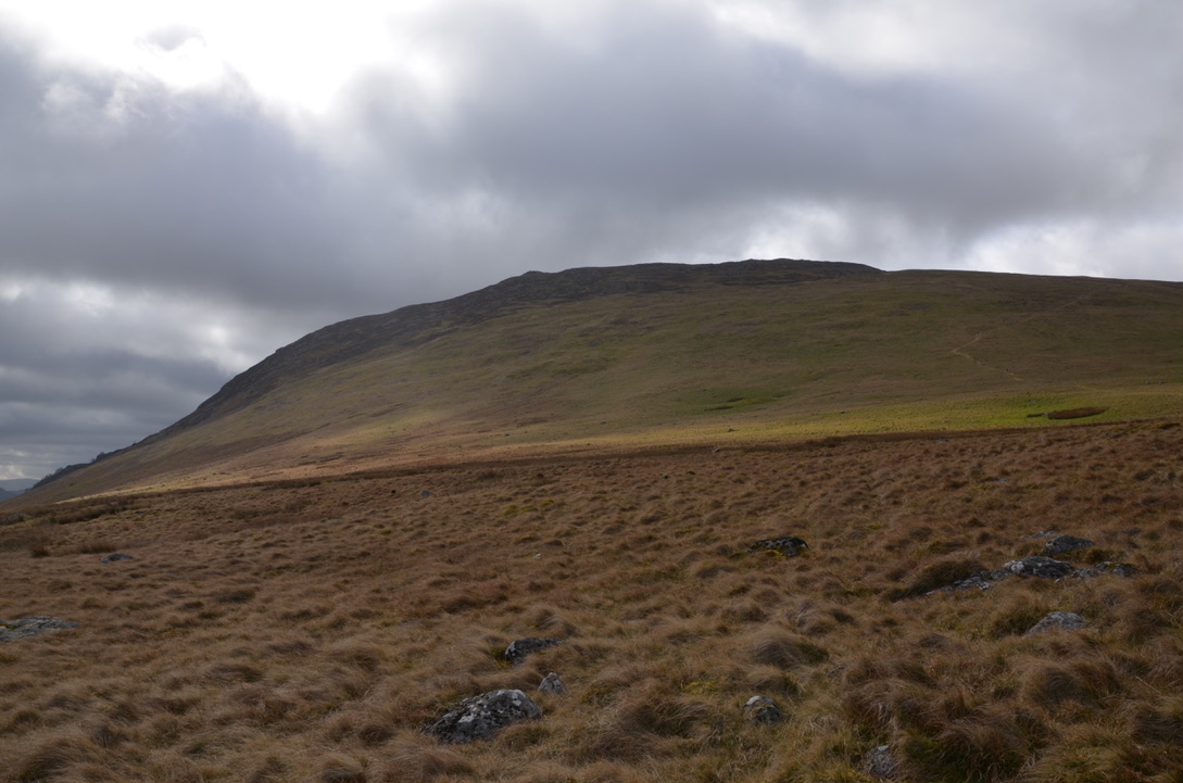
-Then go down towards Round Knott. Once on the flat, leave the trail that goes to Round Knott to take the one on the right that goes down towards the national road.
-Puis redescendre en direction de Round Knott. Une fois sur le plat, laisser le sentier qui va vers Round Knott pour prendre celui de droite qui redescend en direction de la route nationale.
-Once on the flat turn right towards the road. Then once on the road turn right to find the car.
-Une fois sur la plaine prendre à droite en direction de la route. Puis une fois sur la route prendre à droite pour retrouver la voiture.
Do you know this place in Lake District?
Connaissez-vous cet endroit du Lake District?


Find all our dog friendly walks in the Lake District National Park in this page. To discover our adventures in the United Kingdom it is here.

I always zoom past to the south of this area heading towards Keswick, but your post has made me think about exploring this less well known part of the Lakes. Merci 🙂
LikeLiked by 1 person
Thank you for your comment. I am happy if I gave you new hiking ideas.
LikeLiked by 1 person